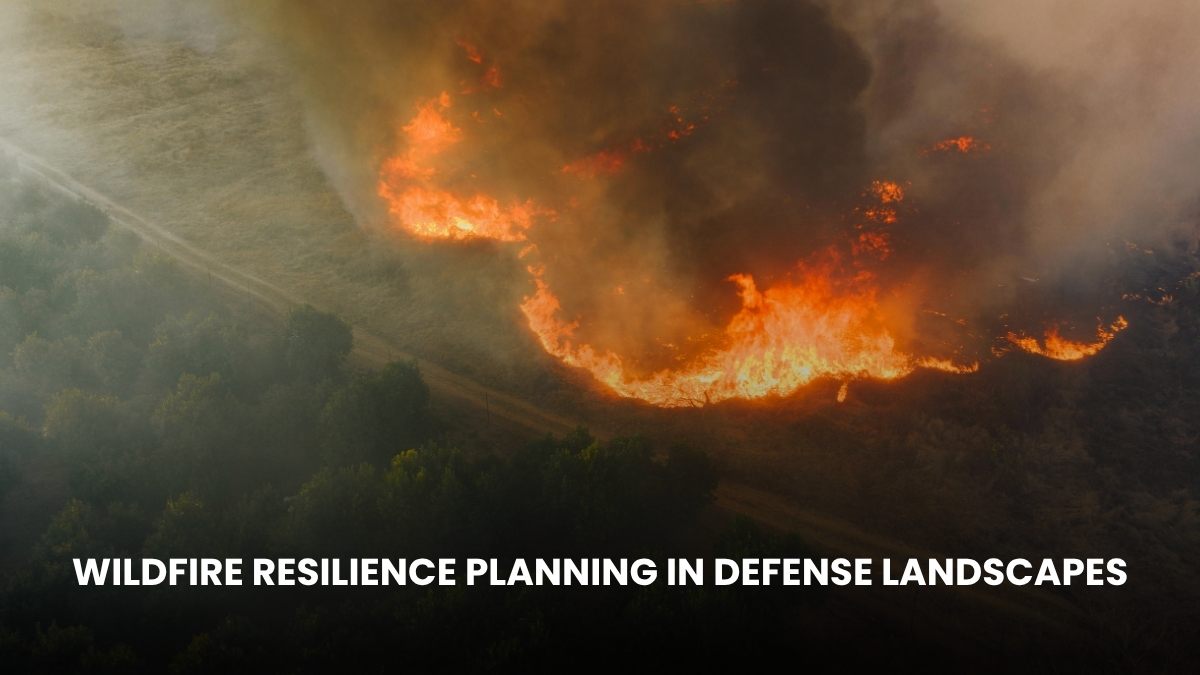
In the last few years, we have seen that wildfire is posing a big challenge in the US, as not only common areas but also defense training areas, base camps, and military lands are getting affected by it. Forest fires are not only damaging the environment but also affecting the training and operations at bases.
The United States Department of Defense owns approximately 27 million acres of land, and about 1 million acres are at risk of fire each year. Recognizing this, the US DoD has integrated wildfire resilience planning as a key component of its climate adaptation strategy.
Currently, the force is engaged not only in preventing wildfires but also in ensuring that the risk of fire is reduced and the natural ecosystem is strengthened as much as possible. Here, you get to know what Wildfire Resilience Planning in Defense Landscapes is and how the US DoD is implementing it.
What is Wildfire Resilience Planning in Defense Landscapes?
Wildfire resilience planning is planning that involves preparing for a wildfire before it occurs, minimizing damage and mission disruption. Its main objectives are as follows.
- Identifying fire hazards,
- Understanding the condition of the soil and vegetation,
- Managing volatile materials, and
- Recovering after a fire.
The US DoD has implemented this at every training range to protect not only the soldiers but also the surrounding community and environment.
Hazard Identification & Risk Assessment
Using the US Department of Defense Climate Adaptation Tool (DCAT) and US Geological Survey (USGS) fire models, the US DoD determines which areas are most vulnerable to fire.
It helps the military understand where they should prepare first to ensure low damage because of the wildfire. The purpose of risk assessment is not only to determine the probability of a fire but also to determine the extent of damage that could occur if a fire does occur.
If a base has an ammunition depot or there are dry bushes in it, then in such a situation fire can be very dangerous; hence, a separate risk map is prepared for each base, which is updated every year.
Integrated Wildland Fire Management Plan
The IWFMP is a comprehensive plan that combines preparation before a fire, response during a fire, and recovery after a fire. Each US DoD installation is required to develop an IWFMP for its land, some of the key tasks of which include hazard identification, fuel management, construction of firebreaks, and safety protocols during training.
Its sole purpose is that even if a fire breaks out, its impact should be minimal and there should be no problem in mission preparation. Along with the Army, local fire agencies and environmental experts are also involved in IWFMP, contributing fully to the proper implementation of this program.
Fuel Management and Prescribed Burning
The wildfires are fueled by accumulated dry bushes, leaves, and wood, colloquially known as fuel. The US DoD has established a policy to control them, using mechanical cleanup and controlled burning in base areas. By doing this, the problem of wildfire is greatly reduced.
It maintains soil fertility and cuts off the path for fire to spread. The US DoD aims to have 25% of the total military base within fuel-treatment zones by 2030, and it will also ensure the environment remains safe and there will be no problems with operations or training at military bases.
Interagency and local partnerships
It’s a fact that wildfires pose a problem to the entire region; it’s not just a problem for one agency. That’s why partnerships have been made with the Department of Defense, Department of Agriculture, Department of the Interior, State Public Works, and local health departments.
A good example of this is the Sentinel Landscapes Partnership, which is making millions of acres around defense lands safe, sustainable, and wildfire-resilient. According to the US DoD, due to collaborative efforts, the problem of wildfires has decreased by 15% in the last 5 years.